
Instrument Expert
Original factory packaging

Service Hotline:
(+86)010-52867771
Instrument Expert
Original factory packaging
Service Hotline:
(+86)010-52867771
Updated:2026-09-14
Views:561
 WeChat
 QQ
QQ
 Online Service
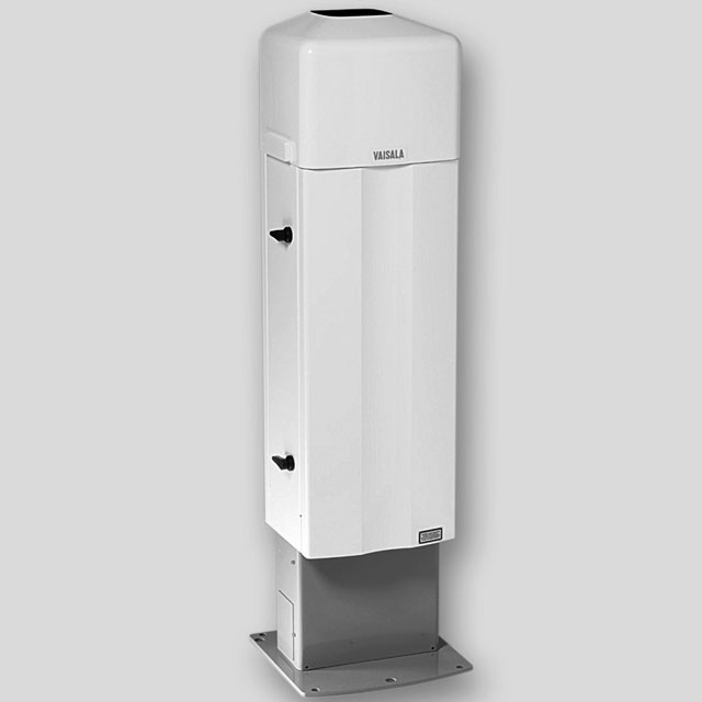
 CL31 Datasheets CL31 User guides CL31 Order forms
The CL31 was designed to deliver cloud baseheight and vertical visibility measurements in alltypes of weather — good or bad. It’s the perfectmonitoring tool for capturing accurate cloudand mixing layer height data meteorologists andaviation specialists need to generate detailedweather prediction models for operational andsafety planning. Advanced sensor and lidartechnology lets you capture three cloud layerssimultaneously, delivering detailed measurementsespecially for low clouds and low inversion layers,precipitation, and fog. Add the optional Vaisala SkyCondition algorithm, and you have an easy andcost-effective way to generate even more usefulinformation from your ceilometer.
Accurate, reliable cloud base heightand vertical visibility data to 25,000ft(7.6km)
Fast, accurate cloud and visibilitydetection is crucial to creating preciseforecasting, situational awareness,and air quality reporting. Even whenthe weather is at its worst, Vaisala’sCeliometer CL31 captures the detailedcloud layer data needed to buildprecision simulations of existingconditions. After all, the quality ofweather modeling is only as good as thedata you collect.
Reliable cloud detection and reporting forcritical operational safety in meteorological andaviation settings
Inputting cloud height and sky condition sourcedata for numerical weather prediction models
Verification of numerical weather forecastingand dispersion models
Generating vertical profiling data toprovide comprehensive understanding ofthe atmosphere
Automatic monitoring of boundarylayer structures
Supporting air quality data processing systemsto study the interaction between pollutants andmeteorological factors
Customer Service QQ
Customer Hotline:
Technical Supports


 3003988120
 yiqi.com
 bio-equip.com
 b2bwork.baidu.com
 baidu.com